The Elevation Plans
An elevation plan is an architectural representation of the building as it would appear in all it's resplendency, if you viewed it in two dimensions, height and width, without the distinguishing quantity of perspective. There are four or more sides to any building, therefore each of the facades would be displayed in this manner. That is two-dimensional drawing, whereas perspective is the art of representing three-dimensional objects on a two-dimensional surface so as to convey the impression of height, width, depth, and relative distance.
I loaded the elevation plans for our house onto the site for you to see; beginning with the view from the North I continue in a counter-clockwise direction.
click on all images to enlarge.
 The North elevation is the facade of our house which will face due North; and I say due North for a reason; the length of the house runs precisely East and West. With views out over the Caribbean Sea to the United States Islands of, St. Thomas and St. John. On the clearest of days, the British West Indies (BWI) is visible with Tortola, just East and North of St. John and Virgin Gorda further to the East. Pretty important this view, notice the windows on that facade, and the specific placement of them. The finished floor of our house will be at 465 feet above sea level, roughly the same as the present grade.
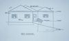
I loaded the elevation plans for our house onto the site for you to see; beginning with the view from the North I continue in a counter-clockwise direction.
click on all images to enlarge.
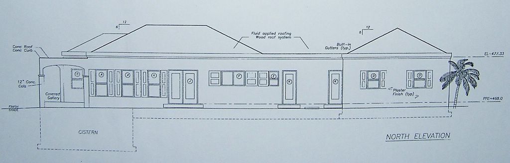 The North elevation is the facade of our house which will face due North; and I say due North for a reason; the length of the house runs precisely East and West. With views out over the Caribbean Sea to the United States Islands of, St. Thomas and St. John. On the clearest of days, the British West Indies (BWI) is visible with Tortola, just East and North of St. John and Virgin Gorda further to the East. Pretty important this view, notice the windows on that facade, and the specific placement of them. The finished floor of our house will be at 465 feet above sea level, roughly the same as the present grade.
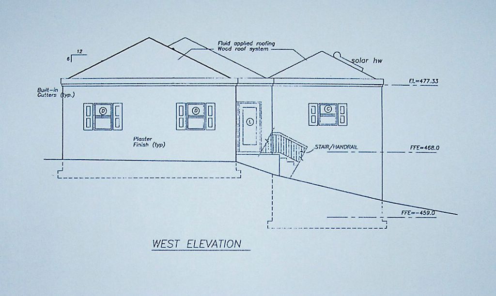
The West elevation faces back into the hillside and toward the neighbors above and beside us; although there aren't any lots with houses actually abutting our property presently, we know the inevitability of the prospect. The 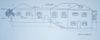 South elevation also faces back into the hillside behind us, where there are onknown landowners at this juncture.
The East elevation is also an important view situation,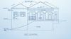 where you see the three outswing double french doors, which exit the house onto the porch, known around these parts as a gallery. We plan to spend a lot of time on the gallery, looking East, with Buck Island in the viewfinder.
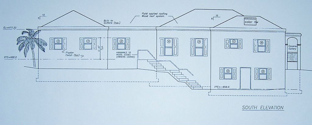 South elevation also faces back into the hillside behind us, where there are onknown landowners at this juncture.
The East elevation is also an important view situation,
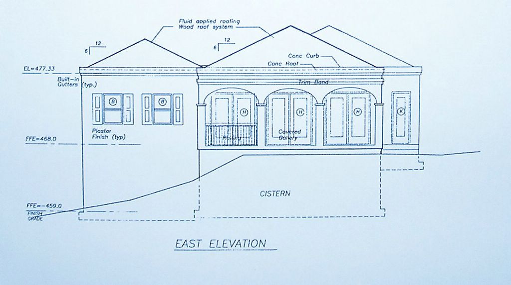 where you see the three outswing double french doors, which exit the house onto the porch, known around these parts as a gallery. We plan to spend a lot of time on the gallery, looking East, with Buck Island in the viewfinder.
 The grade, which represents the ground, is demarked on these drawings by the line running horizontally across and under the building, from left to right and leaves a drop-off from the porch of over three feet. The architect drew in a railing for that front gallery, where there is a problem with the grade, on both the East and South facing arched openings.
One of the items on Debbie's punch list is no stairs anywhere, of any kind, OK, maybe those three steps in the swimming pool, but that's it! No stairs, no railings period! we will bring the grade up to meet that gallery floor and away goes the need for the railing, right?
posted by David at 6:06 PM
![]()
![]()

0 Comments:
Post a Comment
<< Home