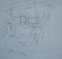
The Plot Plan

The Plot
As you can see from the Plot Plan of our parcel, there is a lot of information on this sheet of paper. The location of the house on the property, the septic system, the driveway and walk locations, with elevation information for each of the components. Note along all the property lines there are numbers, i.e.: which read: N 4º (degrees) 09' (minutes) 14" (seconds) E. That means that particular property line runs from the South-South-West to the North-North-East; only 4 degrees, 9 minutes, 14 seconds from true North, whereas true North would be 00 degrees, 00 minutes, 00 seconds. In this context, North is at the Top of the Page. Our house is aligned on a West - East Meridian and, due to this, we have Buck Island in the crosshairs looking due East through the Great Room; the Gallery, Buck Island, and finally to infinity, and beyond! Why does that sound familiar, Buzz?
To the North, St. Thomas, St. John, of the U.S. Territories; Tortola and Virgin Gorda of the British Virgin Islands. They are all called all Virgin Islands in the area here, named by Chris Columbus as he passed by St. John, Tortola and The Fat Virgin, Gorda, and landed on St.Croix in 1493. It was obvious to everyone what influenced the Italian dude on this decision to name these islands, after how many months at sea? Jeez, ya think? 

0 Comments:
Post a Comment
<< Home